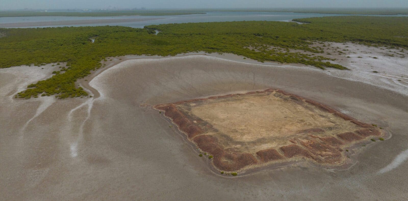
The fertile plains of the Indus Delta have served as a cradle for human civilization since ancient times. Over millennia, the Indus River has connected the empires of the delta and its hinterlands to the rest of the ancient world through the Arabian Sea. The delta’s rich maritime heritage is evident in the many historical ports and cities that once flourished within it. Today, these once-thriving cities lie in ruins, testament to the rise and fall of kingdoms and dynasties long lost to history. Many of these sites remain shrouded in mystery, their stories waiting to be uncovered, their destinies determined by the ever changing landscape of the delta
and the wayward meanderings of the mighty Indus River. their destinies determined by the ever changing landscape of the delta and the wayward meanderings of the mighty Indus River. The Lost Cities of the Indus Delta is an innovative digital heritage trail designed to bring these forgotten cities to life. It takes you on a captivating journey through the creeks, islands, and mangrove forests of the delta, offering an interactive and immersive experience of its rich history. By the end of this virtual exploration, you’ll emerge as an expert on the Indus Delta’s remarkable past.
The fertile plains of the Indus Delta have served as a cradle for human civilization since ancient times. Over millennia, the Indus River has connected the empires of the delta and its hinterlands to the rest of the ancient world through the Arabian Sea. The delta’s rich maritime heritage is evident in the many historical ports and cities that once flourished within it. Today, these once-thriving cities lie in ruins, testament to the rise and fall of kingdoms and dynasties long lost to history. Many of these sites remain shrouded in mystery, their stories waiting to be uncovered, their destinies determined by the ever changing landscape of the delta and the wayward meanderings of the mighty Indus River. their destinies determined by the ever changing landscape of the delta and the wayward meanderings of the mighty Indus River. The Lost Cities of the Indus Delta is an innovative digital heritage trail designed to bring these forgotten cities to life. It takes you on a captivating journey through the creeks, islands, and mangrove forests of the delta, offering an interactive and immersive experience of its rich history. By the end of this virtual exploration, you’ll emerge as an expert on the Indus Delta’s remarkable past.
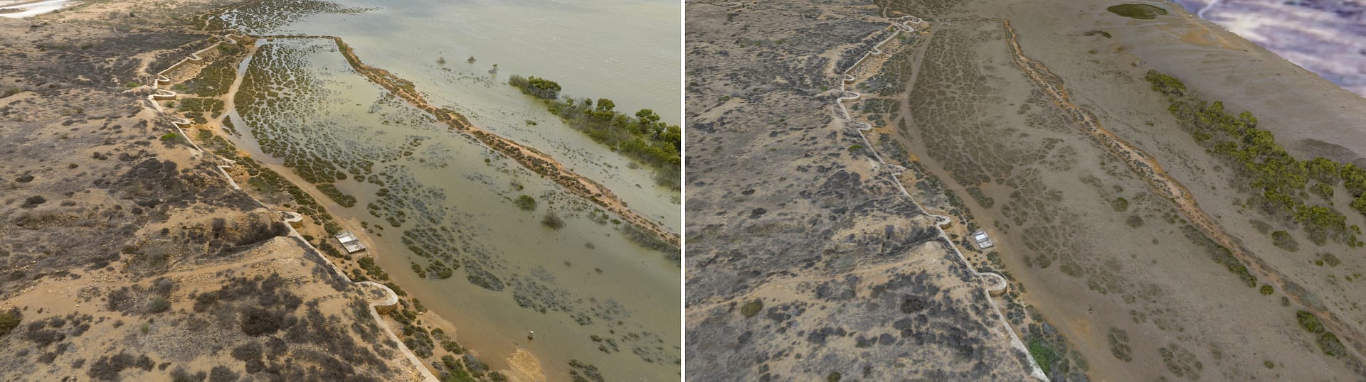
Creating a digital twin of archaeological sites. The original picture of Banbhore is on the left with the model on the right
Aims of the Project
As part of the Digital Heritage Trails Project (DHTP), The Lost Cities of the Indus Delta aims to bridge the gap between people and their heritage. Many of these sites are challenging to access due to their remote locations and the inherent dangers of navigating the delta. By digitally bringing these distant archaeological sites to audiences worldwide, the project overcomes these obstacles and makes heritage more accessible. The trail tells the story of these ancient places
through an engaging, immersive, and interactive experience. Recognizing the vulnerability of these sites to climate change, the project also seeks to preserve them digitally. By using non-intrusive photogrammetric techniques, MaritimEA has created high-resolution 3D models of the sites. These models not only support effective site management and monitoring but also aid in heritage conservation and the mitigation of climate-related impacts.
As part of the Digital Heritage Trails Project (DHTP), The Lost Cities of the Indus Delta aims to bridge the gap between people and their heritage. Many of these sites are challenging to access due to their remote locations and the inherent dangers of navigating the delta. By digitally bringing these distant archaeological sites to audiences worldwide, the project overcomes these obstacles and makes heritage more accessible. The trail tells the story of these ancient places through an engaging, immersive, and interactive experience.
Recognizing the vulnerability of these sites to climate change, the project also seeks to preserve them digitally. By using non-intrusive photogrammetric techniques, MaritimEA has created high-resolution 3D models of the sites. These models not only support effective site management and monitoring but also aid in heritage conservation and the mitigation of climate-related impacts.
As part of the Digital Heritage Trails Project (DHTP), The Lost Cities of the Indus Delta aims to bridge the gap between people and their heritage. Many of these sites are challenging to access due to their remote locations and the inherent dangers of navigating the delta. By digitally bringing these distant archaeological sites to audiences worldwide, the project overcomes these obstacles and makes heritage more accessible. The trail tells the story of these ancient places through an engaging, immersive, and interactive experience. Recognizing the vulnerability of these sites to climate change, the project also seeks to preserve them digitally. By using non-intrusive photogrammetric techniques, MaritimEA has created high-resolution 3D models of the sites. These models not only support effective site management and monitoring but also aid in heritage conservation and the mitigation of climate-related impacts.
How was it done?
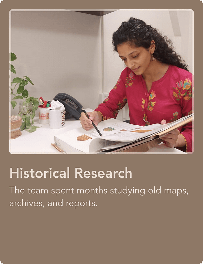
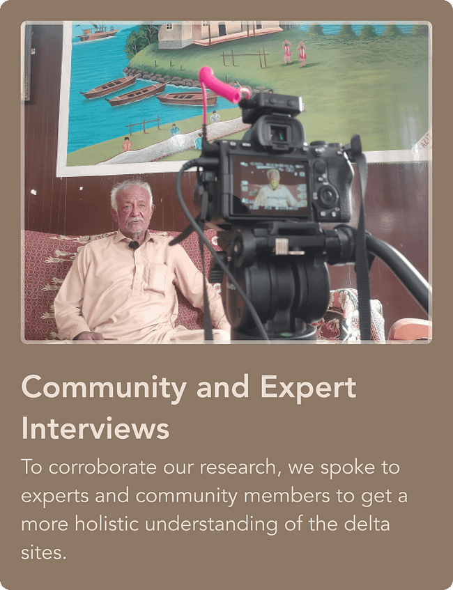
The project employed a range of tools and techniques to curate this unique heritage experience. Extensive historical and archival research laid the foundation, uncovering details about the sites’ origins, purposes, inhabitants, and eventual decline. Where historical accounts were lacking, the team relied on archaeological reports and engaged directly with archaeologists and historians who had worked on these sites. These experts shared firsthand accounts of their experiences and the challenges they faced in interpreting the archaeological evidence.
The project also drew upon the invaluable knowledge of local fisherfolk, who shared community stories and folklore about how these sites have transformed over the years and how they continue to intersect with the
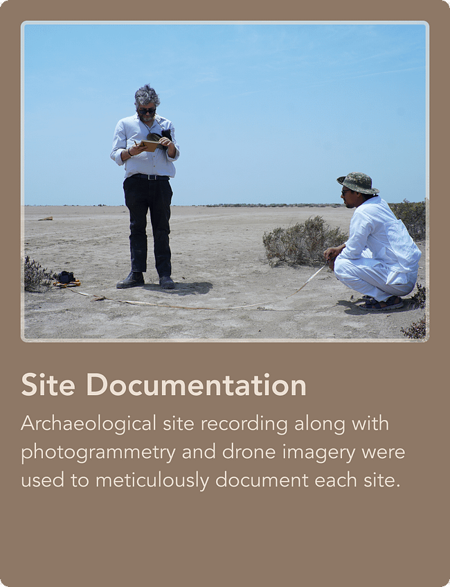
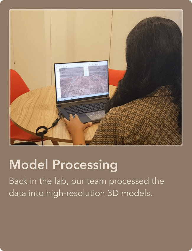
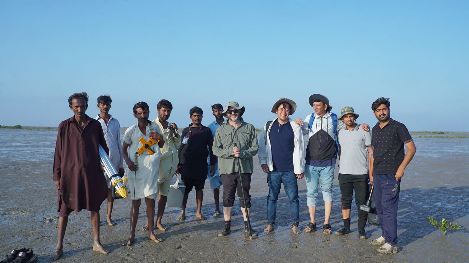
lives of local communities. Fieldwork formed a crucial part of the project, with the team spending weeks navigating the delta’s challenging terrain—trudging through mudflats, mangrove forests, and coastal islands. Local fishermen generously offered their assistance, providing transportation on boats and motorcycles to access the remote sites. The data gathered from these visits was meticulously processed to create detailed 3D models of these places.
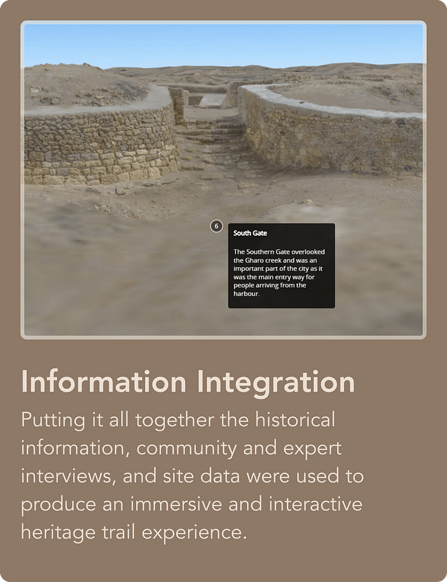
Finally, the diverse sources of information—historical materials, community and expert interviews, and 3D data—were integrated to craft the Lost Cities of the Indus Delta experience. We invite you to explore this extraordinary digital journey and uncover the secrets of the Indus Delta.
The project employed a range of tools and techniques to curate this unique heritage experience. Extensive historical and archival research laid the foundation, uncovering details about the sites’ origins, purposes, inhabitants, and eventual decline. Where historical accounts were lacking, the team relied on archaeological reports and engaged directly with archaeologists and historians who had worked on these sites. These experts shared firsthand accounts of their experiences and the challenges they faced in interpreting the archaeological evidence.
The project also drew upon the invaluable knowledge of local fisherfolk, who shared community stories and folklore about how these sites have transformed over the years and how they continue to intersect with the lives of local communities. Fieldwork formed a crucial part of the project, with the team spending weeks navigating the delta’s challenging terrain—trudging through mudflats, mangrove forests, and coastal islands. Local fishermen generously offered their assistance, providing transportation on boats and motorcycles to access the remote sites. The data gathered from these visits was meticulously processed to create detailed 3D models of these places.
Finally, the diverse sources of information—historical materials, community and expert interviews, and 3D data—were integrated to craft the Lost Cities of the Indus Delta experience. We invite you to explore this extraordinary digital journey and uncover the secrets of the Indus Delta.
The steps involved in developing the heritage trail experience were
Behind the Scenes
A quick look at the MaritimEA team working in the field
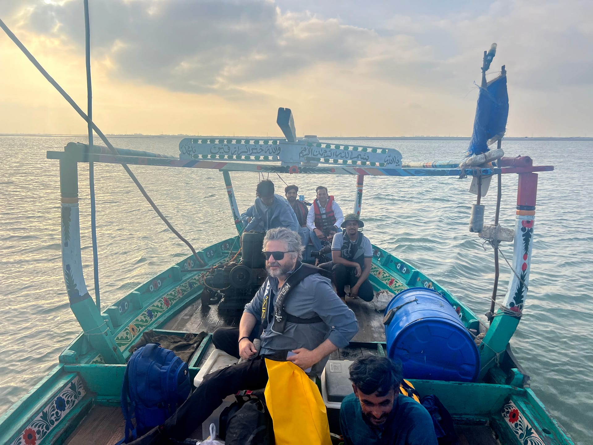
Heading out to the islands on a local fishing boat
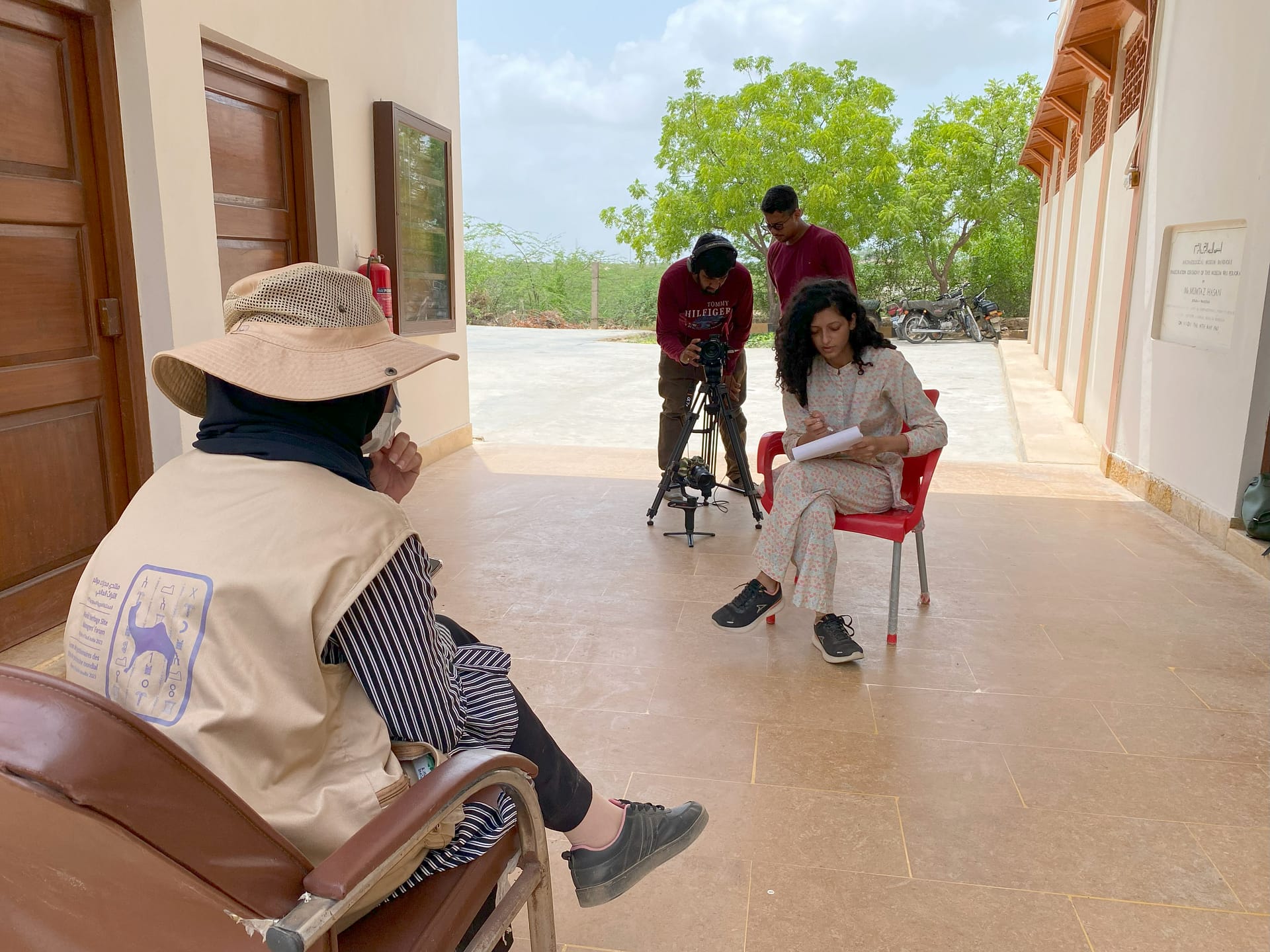
Conducting expert interviews at Banbhore
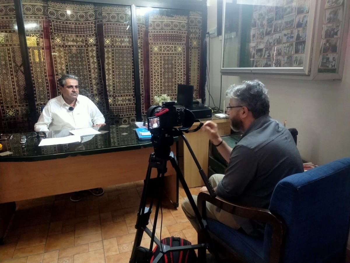
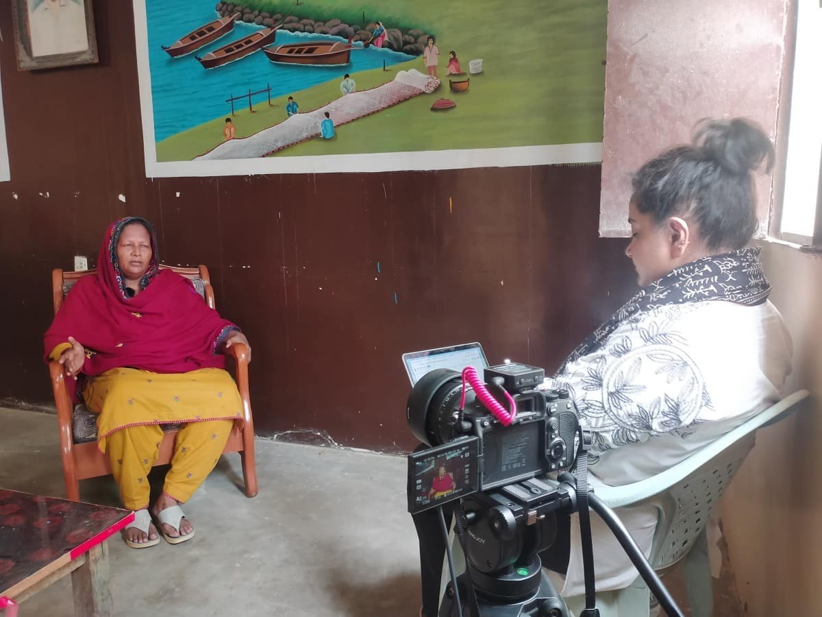
Interviewing local researcher, Mr Abubakar Sheikh, in Thatta
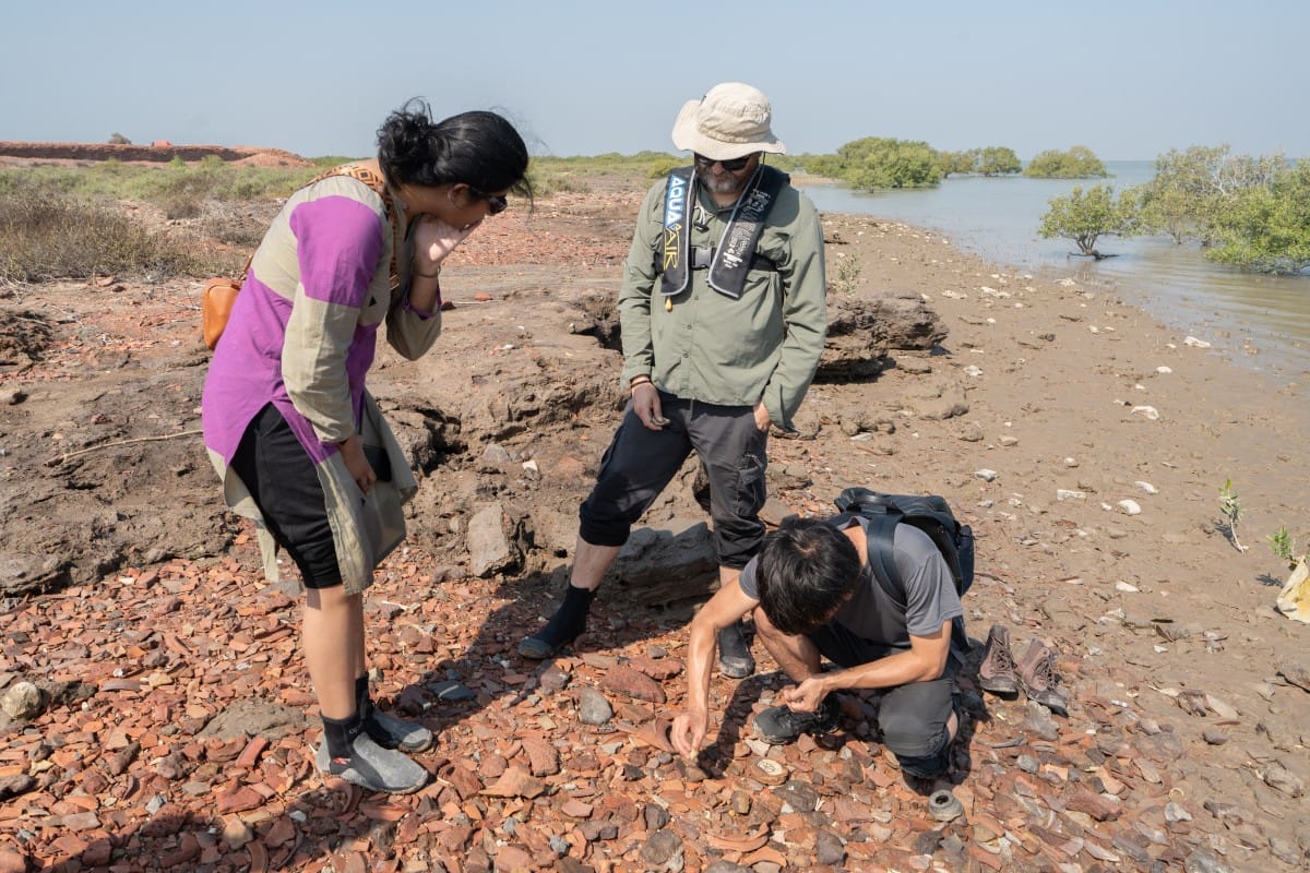
Assessing ceramic remains at Lahiri Bandar
Behind the Scenes
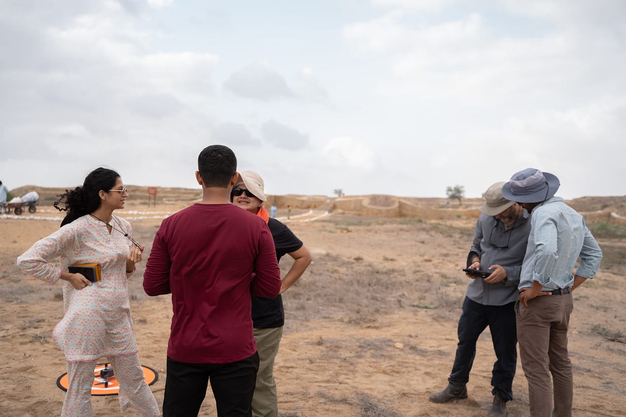
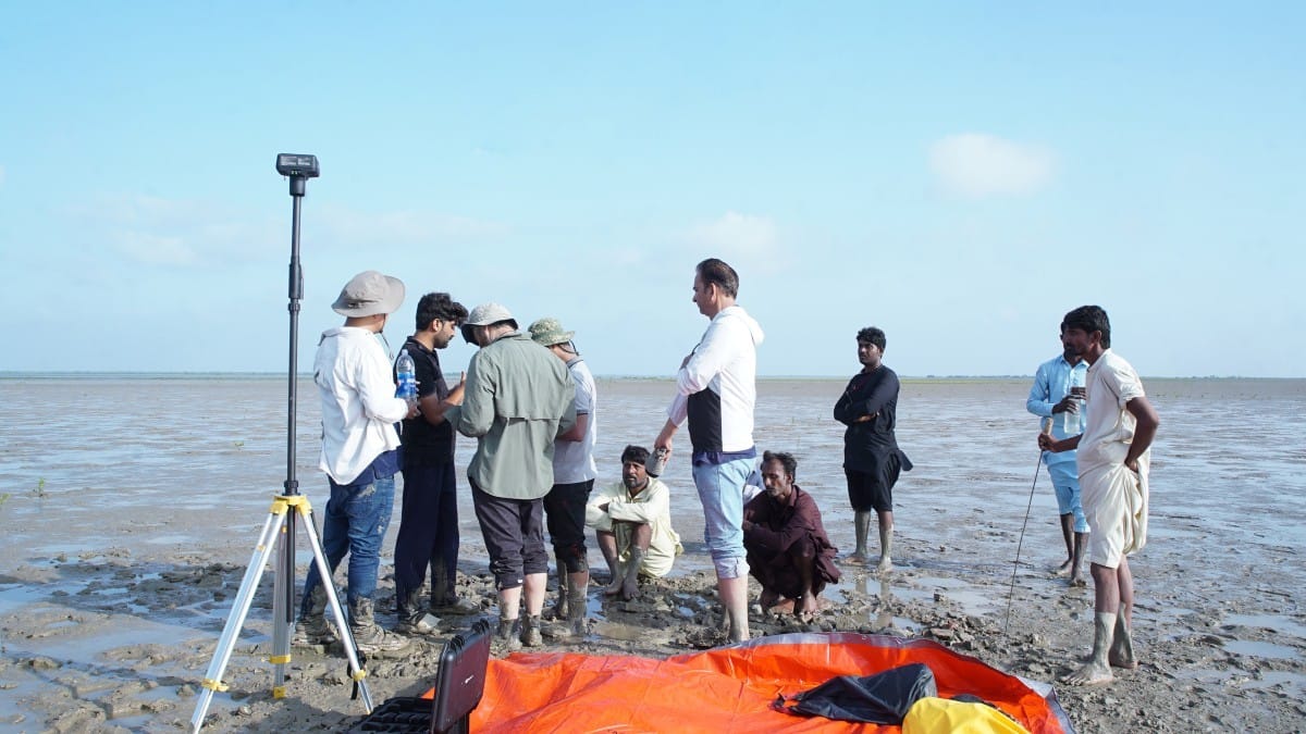
The MaritimEA team discussing plans for the survey
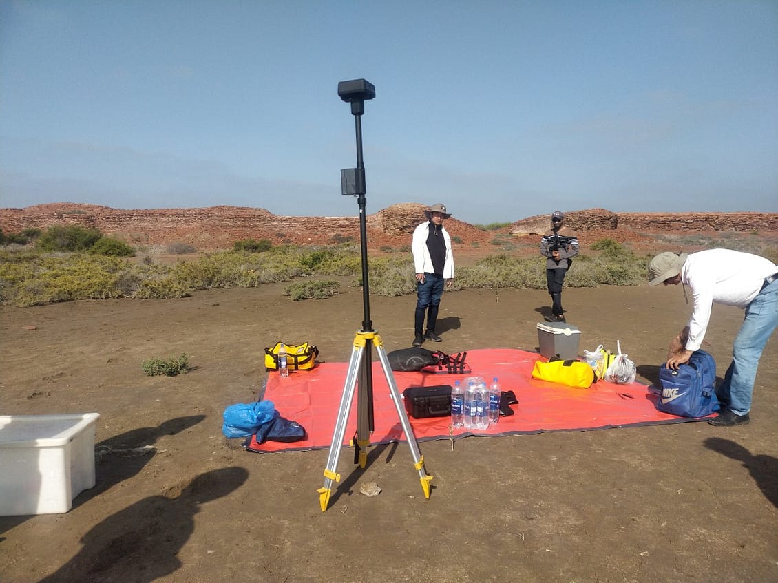
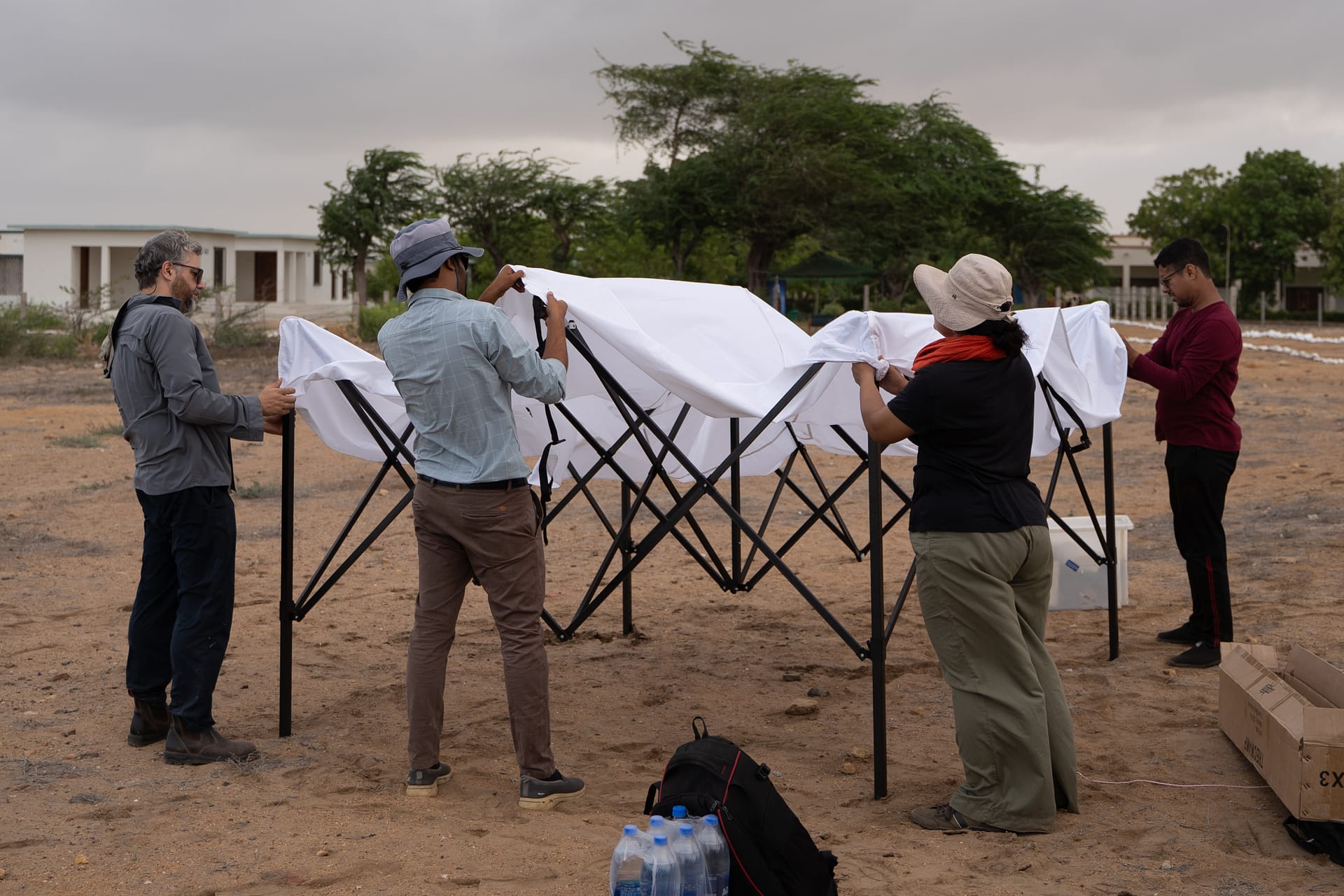
Setting up for a long day of drone surveys at Banbhore
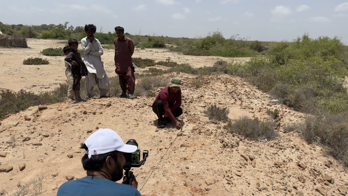
Recording control point distances while working at the Ranokot fort
Water levels rising at Jam Jaskar before the team had to evacuate
Setting up for the site survey of Lahiri Bandar
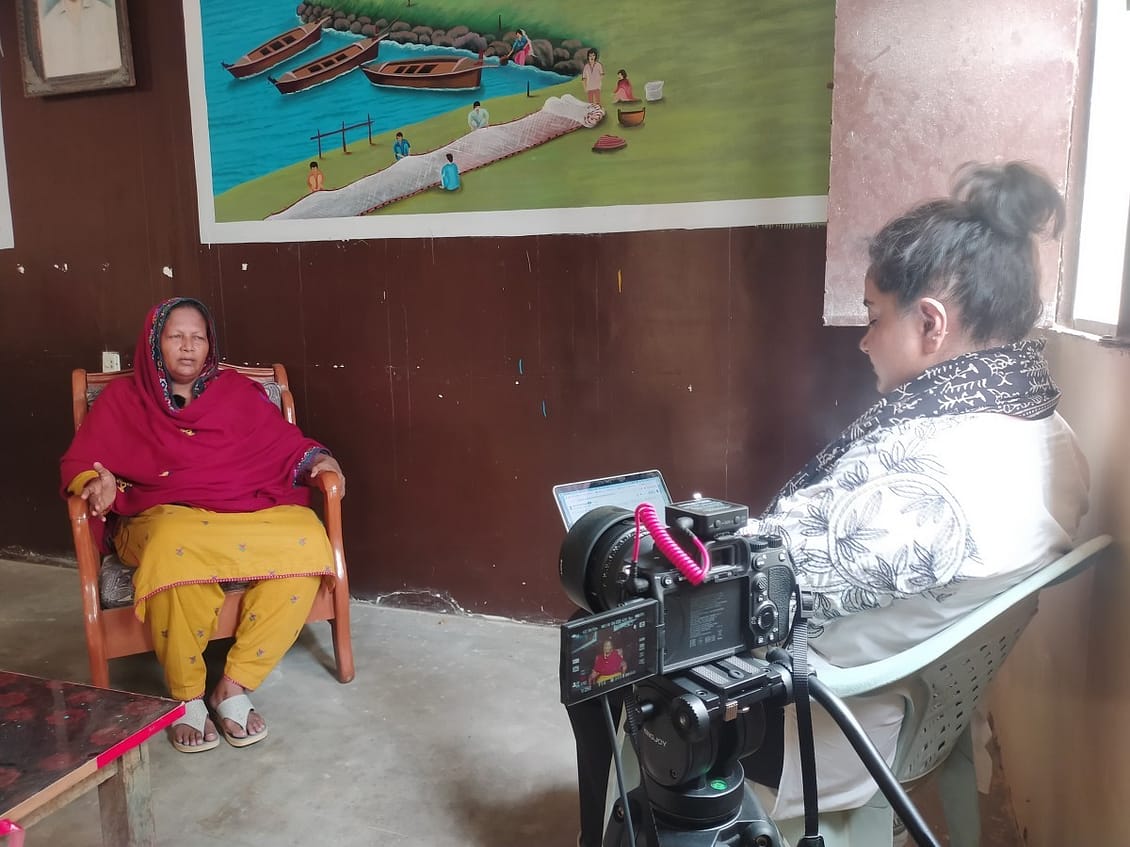
Interviewing community leader, Ms Fatima Majeed in Ibrahim Hyderi
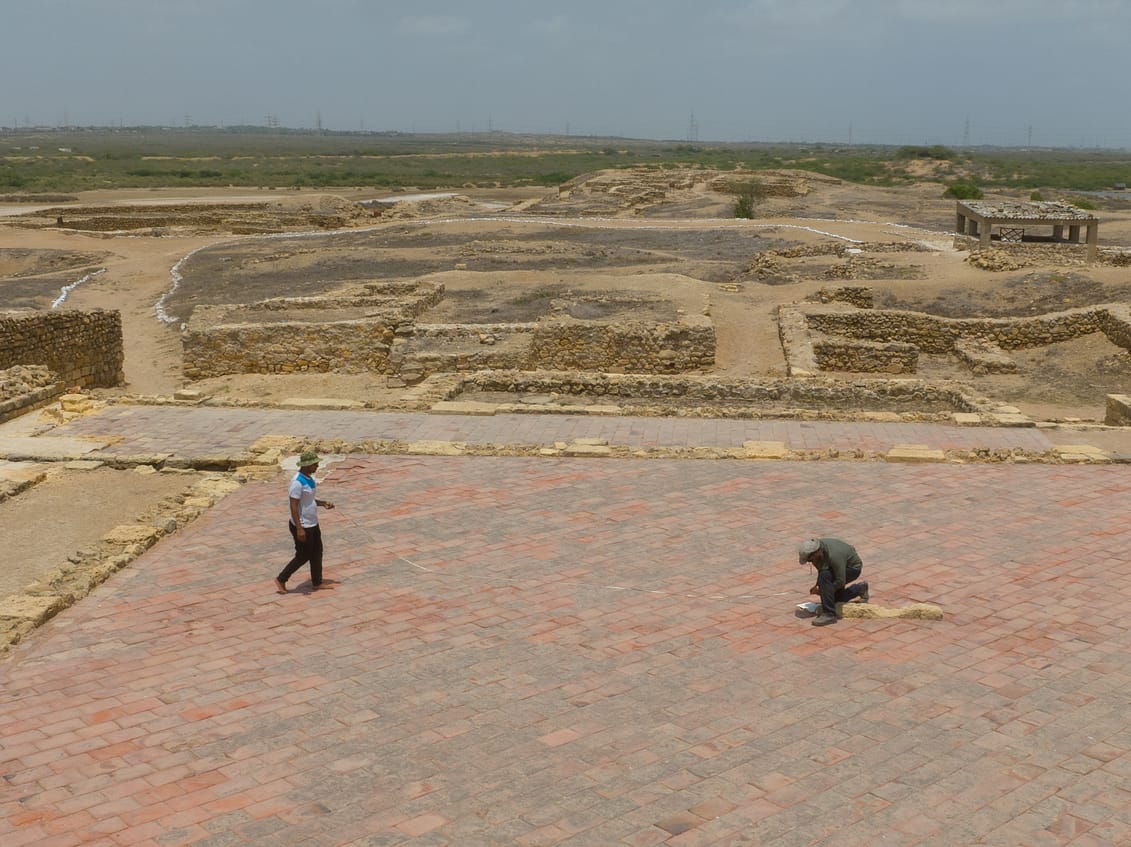
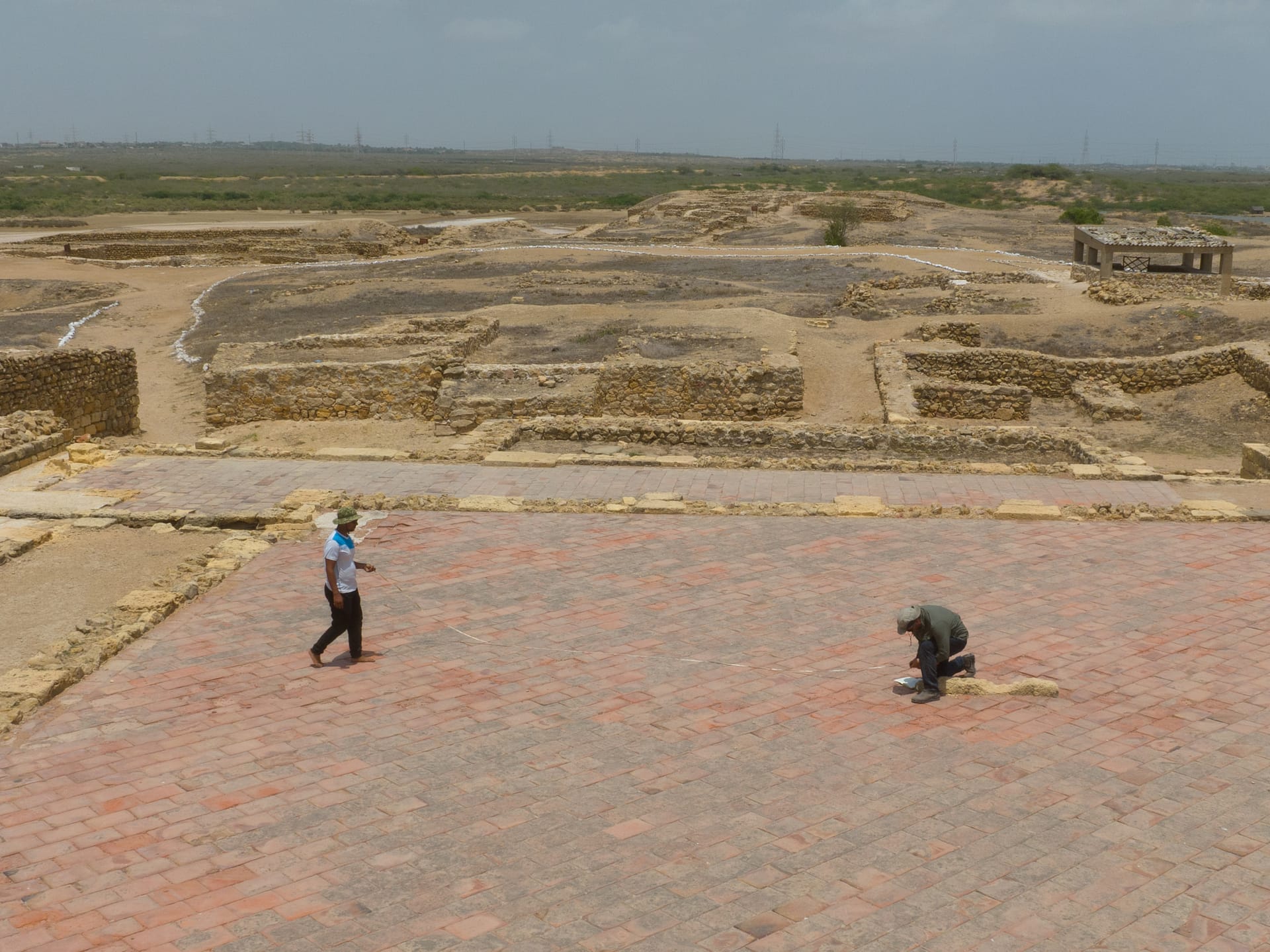
Taking detailed measurements at Banbhore
Meet the team
Our multidisciplinary team has over two decades of experience working in the Indian Ocean and Asia-Pacific region.
Amer Bazl Khan
Director
Amal Hashim
Project Specialist
Madeeha Syed
Project Manager
Mohammad Ahmed
HR & Office Admin
Ramsha Siddiqui
Research Associate
Shabib Asghar
Field Coordinator
Partner Organisations
The Lost Cities of the Indus Delta, a part of the Digital Heritage Trails Project, has been developed by MaritimEA Research, in partnership with Kaspar Consulting and A.P.P.A.R.A.T.U.S. LLC / CHRONONAUT.
Supported by
The Digital Heritage Trails Project is generously supported by the Cultural Protection Fund, in partnership with the British Council and the Department for Culture, Media, and Sport.
Acknowledgements
MaritimEA would like to acknowledge the assistance and support of the following individuals and institutions


